

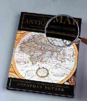
Jonathan Potter: Collecting Antique Maps
Collecting Antique Maps combines a general history of printed cartography with extensive information for potential and established collectors:
- copiously illustrated with over 100 colour and numerous black and white photographs
- describes maps from the 15th to late 19th centuries covering all areas of the world, including the British counties
- has sections detailing the history of town plans, sea and celestial charts
- discusses the work of most major European mapmakers
- collectors' price guide index
LOOKING AT MAPS deals with collecting; how to look after maps and begin a collection.
MAPPING THE WORLD AND ITS COUNTRIES focuses on the great variety of printed maps, charts and plans of all areas of Britain and the world by most British and European mapmakers.
GLOBES, CURIOSITIES AND MINIATURES looks at maps with a difference; maps as objects, celestial and thematic charts, and maps of amusement.
Collecting Antique Maps - A New Edition with Price Guide
An Introduction To The History of Cartography
By Jonathan Potter
This edition (with Price Guide) was published in 2001.
pp.219 including illustrations
ISBN 0-9511577-6-0
ISBN-13 9-780951-157763
An Introduction To The History of Cartography
By Jonathan Potter
This edition (with Price Guide) was published in 2001.
pp.219 including illustrations
ISBN 0-9511577-6-0
ISBN-13 9-780951-157763
Now out of print but copies occasionally become avaliable. Please enquire for details.