
A Map Dealer's Reflections on the Last Forty-Five Years
I was recently invited to present a talk in the “Maps and Society” series at the Warburg Institute, London. This lecture series has been running for 25 years and has featured talks from many of the map world’s leading experts and academics on numerous cartographic topics. JP Ltd has been pleased to have been a supporter since its inception.
The essay/article below is a précis of that talk, and will, I hope be of interest to anyone, whether already familiar with much of this background or new to the fascinating world of old maps.
This is a personal view of what continues to be a very fulfilling and enjoyable career – I have been paid to do a hobby. Some might say this is self-indulgent, not much good for anyone except those who like out-of-date, possibly expensive, perhaps interesting pieces of paper, but if you work with maps, study or collect them, you appreciate their significance as vivid, often attractive, records of the past and as documents that merit attention.
Many people, on seeing or hearing that I sell antique maps for a living, say “how fascinating – how did you get into that?” As a young teenager I’d regularly visit London’s Portobello Road with my parents, enthusiastic collectors of all sorts of antiques. Portobello, in Notting Hill, was not just an antique market but an area where swinging London was much in evidence but I also found myself attracted to the piles of old maps to be rummaged through on general stalls and particularly the displays of dealers such as Eric Taylor, Edna Whiteson, the Burrs and Avril Noble – dealers who not only tolerated the fact that I might occasionally only spend pocket-money amounts but also would ask questions and occupy their time.
My interest continued, as a very minor collector rather than from an academic viewpoint throughout my teens and became very useful in starting a career when I began working at Sifton Praed, now better known as the Map House in Knightsbridge but then in St. James Street, London. I began working there in 1970 as I needed a daytime job in London whilst I pursued a Geography Degree course at Birkbeck in the evenings.
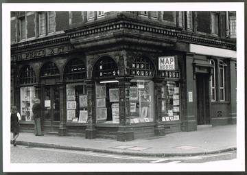 The Map House (left: St James's, c. 1975) at that time a competitor to Edward Stanfords as the UK’s leading suppliers of modern maps and guidebooks from the OS to Blue Guides, and national surveys to Baedecker and Rand McNally, was under new ownership, new management and a change of direction and my small knowledge of old maps, essentially knowing the difference between a Speed, a Morden and a Cary, proved more useful as a career definer than I ever anticipated.
The Map House, then, had just one and half plan chests with old maps and the directors were keen to expand that aspect of business in preference to the low margin and quite labour intensive modern retailing business. My little knowledge and some luck, saw me become shop manager within a year, by which time I had (I am embarrassed to say in such erudite company) abandoned Birkbeck and committed myself, for the time being at least, to retail. Little did I realise then that I had, through good fortune, fallen into a specialised niche that I would enjoy as a full time career.
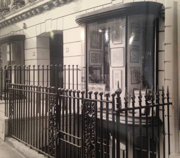
The Map House moved premises to Beauchamp Place in 1975 and, in partnership with the Directors of the Map House, Jonathan Potter (Antique Maps) Ltd was incorporated in 1976. The partnership was dissolved, very amicably, two years later and I moved into first floor premises in Sackville Street, the first of a number of locations I have enjoyed in London over nearly 40 years.
Below: Jonathan's various premises over the years: Grosvenor St, Grafton St, New Bond St.
In 1970, there were no Map Societies, no Map Fairs, no map magazines and only a handful of general reference books and, of course, no Internet or mobile ‘phones. There were few general books about maps although learned journals, such as Imago Mundi and some not widely available studies into carto-bibliographic themes by and for academics existed. However, there were map and print shops, antique shops and antiquarian bookshops in London and around the country which sold old maps.
The first established map shop I recall visiting was Baynton-Williams, then in the Lower Brompton Road, and Jon Ash, by the 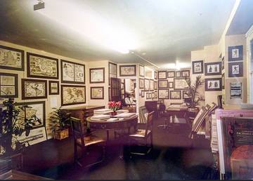 Bank of England, then still run by the founder and before being carried on by Laurence Worms. It is remarkable to see both businesses, or, their leading participants still very much involved in the map business – in fact one of the best reference works of recent years has been “British Map Engravers” a collaberation between Laurence and Ashley B-W.
The old map business was seen as an adjunct to the antiquarian book trade as the recent trend towards specialisation, in all areas, had not yet taken hold and most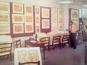 bookshops had a folder or rack of old maps, if not a plan chest and many parts of London and most county towns would have sources where a collector might hope to find something interesting.
About 1970 in London, besides the dealers in Portobello Road, one of whom is still there now, in addition to Baynton Williams and Jon Ash (a general bookshop with a large selection of maps), there was Weinreb & Douwma, Reader’s shop in Charing Cross Road, J.A.L.Franks, Parker Gallery, Map House and general antique markets, such as King’s Road Chelsea with dealers offering maps. Additionally many major booksellers had folders or drawers of maps – Maggs Bros, Stanley Crowe, and so on.
And, of course, there was Francis Edwards where the legendary R.V “Mick” Tooley dominated, in a very discreet way, the London, and by extension the world antique map market.
Prominent among UK map dealers were also P.J.Radford in Uckfield, Richard Nicholson Chester, and Magna Gallery, Oxford, which being outside London operated an active mail order catalogue business to supplement their retail premises. Add to these, Frank Hammond, Peter Barrie, Charles Traylen, Tony Beech and other antiquarian booksellers around the country.
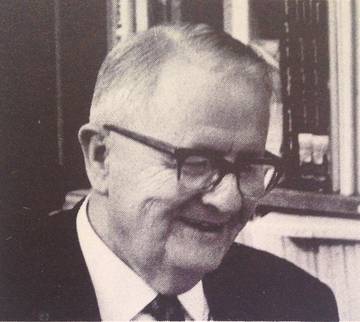 An obituary of 1986 subtitles Mick Tooley (right) as the “Creator of appetite for old maps” and his influence on many of the major map collectors and map dealers from around the world during the middle part of the 20th century cannot be overstated. Besides the many important map collectors who started their collections and were guided by Mr Tooley, the role of Francis Edwards as a clearing house or distribution centre for the world’s map trade, helped to establish London as, arguably, the centre of the world’s trade.
Many are the times I have been visiting North American dealers to be told about “the good old days” - when they visited Francis Edwards and Mick would have a pile “this high” of great maps of America from Waldseemuller to Blaeu to Jefferies and so on. Equally he would offload, or deal, European maps according to their country so the content of a world atlas could be disbursed to its best advantage around the globe.
The role of the American Map Trade and its influence on London dealers was two-fold in that, not only did the trade come to London and Europe to buy, but newly enthused American collectors found their way to London where we spoke their language. Besides established antiquarian booksellers such as Kraus and Argosy in New York, Ken Nebenzahl in Chicago, Howell and Heritage on the West Coast and Goodspeed’s in Boston a number of map and print specialists were setting up and introducing cartography to a very wealthy and eager clientele. Dick Arkway, Walter Reuben, Jill Scopazzi, The Altman Department Store, and, most prominently …….
W.Graham Arader III, a recent Yale graduate who, with several fine galleries around the States and exhibiting in the most expensive antique shows showed maps and prints as fine art – with fine art prices! His retailing acumen was unlike anything else in the staid antique map world BUT he introduced the subject and encouraged many who became serious collectors.
Amongst his many contributions to the marketplace was this catalogue “The Arader Grading System” within which, by grading maps on 4 elements - conceptual importance (Primal Impact to All other material), aesthetic quality (superb to not rated), condition (mint scoring 10 and Less than fair 1)and rarity (9 categories from one known example to common), any map could be rated in order to aid the prospective buyer. Of course much of such categorising is subjective but this was an interesting approach to try to bring maps in line with, for instance, stamps perhaps the closest allied collecting area.
By the mid 1970’s a number of other dealers were setting up in London in a field which, much due to Mick Tooley’s influence, was becoming increasingly popular. Amongst these were a number of businesses with a new approach to a genteel pastime – selling maps as investment items. The most active of which was the Mapseller business, an off-shoot of the Stanley Gibbons stamp business, and now in serious financial trouble due to over-ambitious forecasting in its on-going philatelic portfolios. Also, and responsible for introducing a number of buyers into the business, some of whom became serious collectors, there was “Collectors Treasures” of Amersham but who had a concession in Harrods, Knightsbridge.
It is also interesting to acknowledge how few books on maps were available to collectors and enthusiasts. At the most scholarly edge of the study “Imago Mundi” was in full flow, as it remains today. But about 1970, the only books in print and with wide circulation would have been Tooley’s “Maps and Mapmakers” published by Batsford and, to a lesser extent Raymond Lister’s “How to identify Old Maps and Globes”. Additionally Bagrow’s “History of Cartography”, G.R.Crone’s “Maps and Their Makers”, Skelton’s “Decorative Printed Maps”, and Tooley, Bricker and Crone’s “Highlights of Cartography” could be found – the last two being very much “picture” books albeit with descriptive text.
Mick Tooley’s contribution to cartographic research produced a vast list of published works of general and specialised content – his “Maps and Mapmakers” being one of the first generally available books on the subject, and still one of the best, while the Map Collector’s Circle series of 110 monographs, many compiled by himself, formed the basis for much subsequent carto-bibliography.
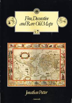
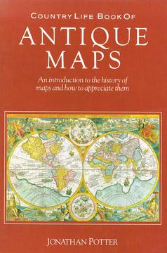 A handful of carto-bibliographic listings existed – Darlington and Howgego’s “Printed Maps of London”, Chubb’s county atlas listings and so on but during the next ten/fifteen years a good number of books appeared, general books by Roger Baynton-Williams, David Bannister, Yasha Beresiner, David Smith and others, including eventually my own contribution to the bookshelf. (right) Also detailed specialised subject listings by Skelton, Rodney Shirley and listings of institutional holdings began to appear.
It is interesting to compare the availability of books about maps, or using maps as their core focus now – a visit to the British Library bookshop or to Stanfords in Long Acre could fill several shopping bags, if they could all be carried, of relevant titles.
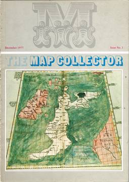 For the purposes of comparison of the development of the map trade in London in recent times, it is very convenient that “The Map Collector” magazine appeared in 1977. (left) Under the editorial guidance of who else but Mick Tooley, the first issue includes some 16 UK and 8 non-UK advertisers of whom 6 are still active.
Tooley’s editorial describes map collecting as, at the start of the century, being “limited to royalty, the nobility and the occasional antiquarian; maps being held in little esteem by the general public … The real explosion came when dealers started breaking up atlases and selling the maps individually. Instead of a few, hundreds of purchasers could be satisfied. It became a profitable business. And success bred success. …. Maps are sought in nearly all countries of the world, as historical documents, as decoration and as an investment. … In the last decade, the rise in popularity and value of early maps has been phenomenal. No other antique has appreciated to such an extent.”
The much loved and popular “Map Collector” ran for almost 20 years after which the pressures of continuing to produce a good quality magazine of, admittedly still a relatively specialised interest in challenging times, proved too great. Not only were the 1990’s a period of great economic uncertainty but the attractions of collecting any antique items were competing against a new “minimalist” approach to decorating and in a period when more and more gadgetary, electronic “must-have” items and holiday opportunities competed for disposable income.
During the lifespan of “The Map Collector” the trade developed significantly with new dealers entering the field, with new approaches, and auction houses taking far greater interest in maps as items of significant value and not just left-overs from book sales.
Contrasting with Mick Tooley’s editorial in the first issue, Valerie Scott comments in 1996 that she can now “surf the internet, search the World Wide Web, navigate with Netscape and check a remore host using Ping.” She also “can hardly wait to turn on my email every morning” – how many people say that now?
Times were changing but even though the magazine’s final issue had some 54 advertisements including 20 UK-based only 3 of those listed a website or email address. But then in the first issue some advertisers didn’t even list telephone numbers, being reliant on posted correspondence or cable communications.
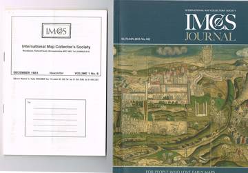
Not long after “The Map Collector” appeared, a composite of map enthusiasts, collectors and dealers, inspired by Malcolm Young, Rodney Shirley and Yasha Beresiner identified the need for an international map collectors society and IMCoS came into being. Many of you will be familiar with the innumerable events and meetings arranged under IMCoS auspices and most probably you have all visited, at one time or another, the London Map Fair. The first of which was held at the Grosvenor Hotel in Victoria, October 1981 with 24 dealers, and now under different management but just as eagerly supported, held at the Royal Geographical Society with over 40 exhibitors (space being limited) and visitors from almost all parts of the world. Of the original group of dealers in 1981, four businesses (Lea Jackson, C.A.Burden , Tooley Adams, Jonathan Potter ltd) are still exhibiting at this June, often sweltering, event.
The success of IMCoS has been marked by the number of localised societies, in the US and around the world which are now flourishing and the number of map fairs and symposia now on the calendar.
The role of the Map Fair has become increasingly important as a forum for not just the trade but for collectors and academics to gather together and, following the success of the London events, others in Miami (the first in 1993), Paris, Breda, Milan and Mantua, Denver and now Chicago have become, or are endeavouring to become established.
Map Fairs have proved popular and important, particularly now, in an age when many dealers prefer to work at home/office and from a desk and laptop rather than an open retail shop.
 Amongst the best sources for anyone wanting to learn about maps and atlases, and not just what they are worth, have been the many catalogues put out by dealers during the last 40 or 50 years. Only a handful of dealers still produce these as, although printing costs have reduced, postage costs have increased disproportionately and collectors become more attuned to buying through websites. Although catalogues of the forties and fifties from the likes of Maggs, Francis Edwards, Traylen, Frank Hammond and the major auction houses listed fantastic items these were frequently described in such cursory manner that little can be learned from them – except just how much material could be found then by the discerning collector – very frustrating. One marked exception to this approach was the series of catalogues from the New York dealer H.P.Kraus whose travels around post-war Europe unearthed innumerable cartographic gems and whose catalogue of 1969, Monumenta Cartographica included many unique and very important items, well described.
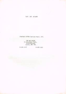
In London, in the period before colour catalogues, from around 1970 to the late eighties the catalogues of Weinreb and Douwma, were and remain wonderful showcases of rare maps with scholarly descriptions for which Tony Campbell has to take responsibility. My own first catalogue, a typed and copied print-out, appeared in 1977 with increasingly large and more comprehensive catalogues appearing until recently.
During this time Tooley Adams, the business created after the break-up of Francis Edwards, Mapsellers, the Stanley Gibbons map dealing department, Baynton Williams with Ray O’Shea, The Map House, Warwick Leadlay, Franks, Clive Burden, Avril Noble, Old Church Galleries, Dawsons of Pall Mall and my own shop ensured London remained a lively and interesting destination for map dealers and collectors – most businesses offering good informative printed catalogues.
 One other feature of the London Map Trade to develop were the monthly map fairs which became established at the Bonnington Hotel. (left) These popular events, inspired by the regular book fairs put on by the Provincial Book Fairs Association, proved very successful for several years, and allowed a London retail presence for out-of-town dealers and those without shops.
In addition the auction houses, predominantly Sothebys, Christies, Phillips and Bonhams had regular sales with varied and interesting lots sometimes well described, but hopefully not so well described. In these pre-internet days attendance was necessary to view and bid and all dealers will have tales of mis-described items or of lots where significant items lay dormant. Nowadays the internet search engines can put any auction at the fingertip of any bidder anywhere – good for the vendor, very good for the auction house which does very little to earn its money, and not so good for the experienced dealer, or of course collector who has spent years learning and looking out for special items.
The auction houses now have a somewhat changed agenda …. in 1970 the two big auction houses, Sothebys and Christies dominated the London market although Phillips and Bonhams also had book sales with sections of maps. Much of the appeal, for a dealer, were the larger mixed and miscellaneous lots, which had no appeal to the specialised collector but could provide general stock for retailing, or for distribution around the trade in different parts of the country. Occasionally one might "get lucky" and spot something of real value, hopefully unseen by lazier or less thorough competitors. One such purchase was a large lot of European maps, acquired at a very reasonable price, and amongst which were the two sheets of a map of the Roman Europe which I had never seen before. Subsequent research proved this to be Ortelius's separate publication "Romani Imperii Imago" - quickly re-sold (and probably too cheaply!)
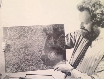
 One of the most distinctive characters, a regular at auctions around Britain and Europe, was Desmond Burgess (right) who's modus operandi was to buy against the established trade and expect to sell on relatively quickly for a smallish margin, much to the frustration of the underbidder! However, his eye and enthusiasm to hoover up lots he considered in any way cheap, brought some great purchases his way - unfortunately neither he, nor I at the time realised just how good certain items were. One of the most interesting lots of the early days was, I think, a remnant of the sale of John Evelyn's books at Christies, at the end of which was a folder of miscellaneous engravings - book dealers weren't interested, map and print dealers didn't notice it in a book sale but Desmond did and bought a folder of separately published English, eclipse, world and other broadsheet maps - in todays terms, a whole catalogue's worth!
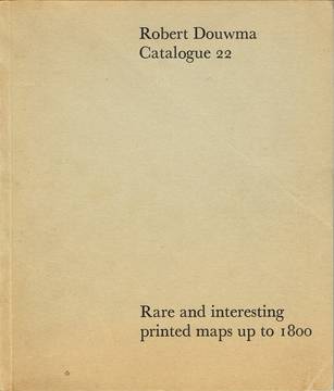
 Tony Campbell (left), at Weinreb and Douwma, was the recipient of a number of these, including the Blagrave planispheres, and which went towards stocking their catalogue no 22.
An auction catalogue of 1968 from Sotheby makes an interesting counterpoint to the massive marketing activity and promotion that lies behind a sale now. Lot 115, “a fine, unrestored” copy of the 1486, Ulm Ptolemy 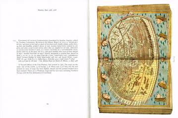 merits a single-page description and one photograph. (left) In the Wardington sale of 2006, the same copy of the atlas was illustrated on the front cover, had two pages of description and 4 illustrations – all preceded by 7 pages describing the history of printed Ptolemaic atlases. In 1968, Sotheby published a list of prices achieved (as they still do) including the names of buyers (which they do not now). 1968, £6,800 to Frank Hammond, sold to Lord Wardington for £9,000 two years later, and in 2006 for a little over £300,000.
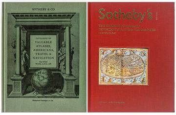
Another distinction between then and now is that the auction houses all now charge the buyer a premium of, perhaps, 25% for bidding successfully. Also the transparency of announcing purchasers make it apparent that the trade’s role, either buying for stock, or on commission for private clients, has changed. Virtually all the 176 items in the 1968 sale were purchased by the trade, now private buyers are much more active (although unannounced as buyers), being advised by the auction houses or backing their own judgement having researched on the internet.
It is hard to believe that the internet has only been with us for a relatively short time - when the last issue of "The Map Collector" was published in 1997 no advertisers, including all major dealers around the world, listed a website presence - now many dealers only have a website presence!
However by the 2002, the "Mercator's World" magazine, an American publication for the map collecting fraternity, almost all 30 advertisers held websites. Mercator’s World lasted from 1996 to 2002 and from 2004 to 2007 “Map Forum” provided a popular journal to fill the gap left by “Map Collector” – the Map Forum had, and still has an internet presence, but maintaining both, in an increasingly web-based world was sadly too challenging.
Our experience of the internet has, as I suspect most users has been, mixed. It has undoubtedly had a strong impact on all aspects not just of how retail business operates, but also how people, whether serious collectors or occasional gift or decorative item purchasers reach decisions. It has proved impossible to ignore, if one wants to retain credibility as a serious retailer whether one likes it or not. And it has clearly led to levelling out of prices - from the top end needing to remain competitive against lower cost sellers, and, from the lower end of the price range having easy access to expert descriptions and professional valuations leading to an upping of otherwise lower prices.
For the first years of the internet, established retailers with shops were undoubtedly disadvantaged as less experienced and lower overhead suppliers could undercut prices. However too many unhappy experiences now seem to be encouraging buyers to do their legwork on line, browsing through websites but, certainly in our case, having the re-assurance an established business gives and the ability to visit a shop to examine what has already been selected on-line.
Of course we use the internet as a research tool, but still rely hugely on the nuggets of information that lie in any number of printed sources - books, catalogues, magazines and pamphlets.
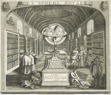 Right: A Paris map shop - 300 years ago
The focus of interest in maps has changed considerably over my time in the business. Prior to around 1990, the concept of collecting, whether stamps, coins, art or Elizabethan furniture was an established pastime with enthusiasts all over Britain and the world. The map market was driven by collectors for almost all areas, whether China, Chesapeake, Germany, Japan, Hampshire or Huntingdon - if a map of any of those areas came in there was a good chance that someone on the mailing list would, if they didn't have it, want it and buy it. Collectors wanted every map of their area of interest.
In addition to the serious collectors - and some were much more serious than others - identifying and enthusing over variants and imprint details ignored by generations of collectors previously, antique maps were bought as traditional decorative items, of interest, antiquity and value.
As a Central London-based dealer, at a time when London was not considered quite as expensive a destination as now, trade was more international than UK-based. Visitors to the shop might come from anywhere although a very high proportion were North American, and, given their varied origins their requirements could be a map of Poland, California or Ireland, for instance. However, we certainly noticed a reduction in American visitors during the nineties and, of course after 9/11.
Times have changed and the "collecting" mentality has largely disappeared. Yes, people may still buy a handful of maps of one area showing the cartographic presentation of its social development over four centuries, but more often they will buy a handful of maps of differing areas by one mapmaker, for more uniform decoration.
 Traditionally sales to buyers from outside the UK, where interest tends to be localised, ie counties rather than countries, have been very susceptible to fluctuations in the financial wellbeing of a country so maps of Japan, for instance, once so sought-after are now hard to sell. Similarly one could list any number of countries, from Germany to Venezuela and Persia to Greece where the local economy, or international crisis have effected demand.
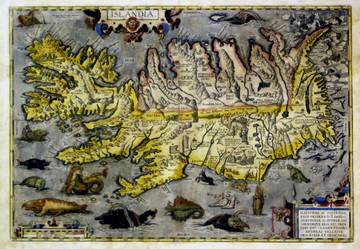
Purchasers’ interest now may be to acquire a smaller number of, what would today be termed “Statement Pieces”, rather than pursuing the traditional concept of collecting every map of a particular area, or by specific mapmakers. An Ortelius map of Iceland might now be displayed next to a London Underground map! And a “collection” might consist of half a dozen maps.
Also, one has to accept that the retail market now offers so many more purchase opportunities than ever before - 40 years ago it was simply not a holiday option to visit Antarctica or the Galapagos; to travel to many other places for a weekend, or go ski-ing in February and the Maldives in June. Motor cars came with road books - not satellite guided computers and one didn't need a television to fill a wall. 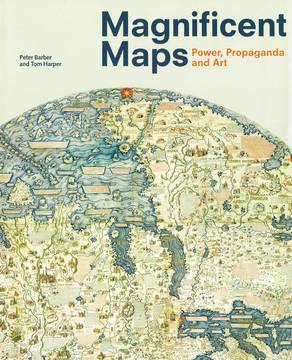
Left: A Great Exhibition!
All this said, interest in old maps remains strong, even if the market has softened somewhat, and anyone with the “ancient cartographic” eye can see old maps used in fashion, shop displays, stationery, art, book illustration and on numerous other commodities. Radio and TV programmes, about or around the theme of cartography have proved very popular, notably those featuring the recent British Library Map Librarian, Peter Barber who has become something of a superstar and the go-to figure for the final word on map history. The British Library "Magnificent Maps" exhibition was, I think, that Institution's all-time best attended.
I have already mentioned the large number of books published on the subject of, or utilising old maps. Overall, this is great news with, for example, Simon Winchester's "The Map that Changed the World" bringing a rather specialised aspect of cartography to a completely new readership, however, another title "Island of Lost Maps" describes one period of the trade's recent history which has caused much discomfort and discussion among trade, collectors and librarians.
Any valuable item, or group of items, are liable to be the target of thieves or those who want something for nothing. Unfortunately, the old map world, has suffered several unwelcome incidents, at the hands of a series of thieves, with attendant publicity which has necessitated soul-searching and reaction from all parties. The major incidents have been thefts from notable libraries, in Britain, Europe and America.
One of the hardest types of thief of detect and stop is the "insider" who perhaps works at that library or a visitor so well trusted that they can be unsupervised while they go about their dastardly deeds. That abuse of trust is very difficult to restore and, although a number of maps stolen in recent times have been recovered and returned, the damage is done. The consequence has been, and hopefully will continue that all parties become more aware of the dangers, librarians and custodians more vigilant and open in reporting theft, and the trade pursuing greater due diligence when offered suspect goods. Tony Campbell has been particularly active, from the librarians' side but also has the advantage of having been in the trade and his representation to CILIP and with the ABA and map trade has created standards that will hopefully be maintained.
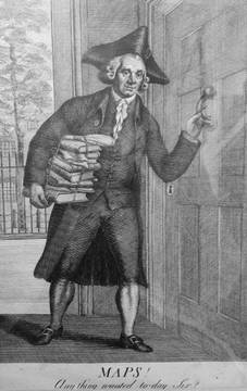
Right: An Earlier Map Business
No-one who has made a business in the map trade can do so without customers – and I am sometimes asked – who buys old maps? Well, as you will know, all sorts of people buy maps, they come from all walks of life and have very differing ways of approaching collecting and the trade – often perceived as the enemy, especially if they are based in London (too expensive) AND particularly if they are in or near Bond Street (too posh and snooty).
One of my first major sales, when in St James Street, was to a dusty looking fellow who parked his bike outside, came in and apologised for the fact that he was in overalls covered in plaster - over the years he has built probably the best private collection of maps of Durham. Other customers we have dealt with wouldn't dream of getting on a bike and wouldn't go near wet plaster.
Amongst these other customers, we have dealt with the Chilean General Augustin Pinochet, who bought any maps which supported a Chilean boundary argument with Peru; a Mexican business man, sometimes listed as the richest man in the world, who wanted 50 Ortelius maps, all looking the same, of the Middle East; and for Margaret Thatcher who bought a map of North America showing California as an Island to give Ronald Reagan.
We have dealt with libraries and institutions the world-over, and, I think, all the major collectors of the last 40-50 years, many of whom have built collections to rival long-established institutions and many of whom have now made, or are in the process of making, their collections and their research available to educate and interest the public – Dallas Pratt, Harold Osher, Barry MacLean, and Tom Touchton are just a few of the names you may be familiar with.
On the other side of business, I am often asked whether I buy old maps? Here’s the exciting bit, for me – this is the “paid for doing a hobby” bit, this is where the collector in me has the excitement of not knowing what I might be offered from one day to the next – usually nothing interesting BUT you never know. I have visited stately homes, viewed maps in garages and garden sheds, travelled thousands of miles and found good items in local auctions. But, contrary to common expectation I have never kept a “personal” collection of the good stuff at home – all the best things have been sold to pay the overheads!
Also, contrary to common expectation, I am pleased to say that we are seeing an increasing number of women buying maps because they like them and not just to give them as gifts – the perception that the map collector is always a male is wrong.
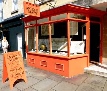
Left: A current Map Business!
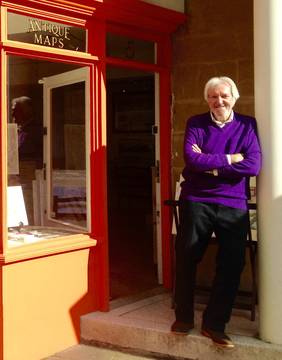
Another mis-conception is that, besides being male, the antique map buyer is older rather than younger. In our gallery in Bath we are being visited and selling to a higher proportion of younger buyers than ever before and the attendance at the London and Miami Map Fairs has a much more youthful presence than in the past. There are even younger people as principals and staff in the trade and at leading institutions (such as the British Library) and as curators and directors of American collections.
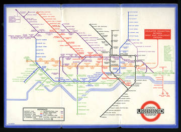
Many of these “new” collectors will have been drawn towards maps by such successes as the “Magnificent Maps” exhibition at the BL and the Chicago Festival of Maps in 2008 and also by the increased TV and radio exposure maps are currently enjoying. The application of cartography by artists such as Grayson Perry, Simon Patterson and others follows in a long tradition from Bunting to Gillray and Fred Rose, the design element in the Harry Beck London Underground plan suits the digital world and the vibrant colours of MacDonald Gill appeal to the need for striking decoration.
Interest in 20th century cartography is evidenced by the success of Tom Harper and Tim Bryars book, and others, featuring maps produced in decorative style, as ephemeral reportage, as propaganda, or in the case of Harry Beck's London Underground map, as iconic pieces of design. It would never have crossed my, or anyone else's, mind in 1977, that in 2016 I would sell a London Underground wall map of that date to an Englishman living in New York who loved the look, wanted a "statement piece" for his apartment and, as so happened, had been born in London in 1977!
What is lacking for the new collector or map buyer are the retail outlets, antique shops, antiquarian book shops and, sometimes, map and print galleries which used to be spread around the country, but in the internet age, even this doesn’t stop people developing an interest in old maps.
Personally, from a business point of view, I have been very fortunate to have had a number of really good young staff throughout much of my time in the trade – many of whom have “caught the bug” and, for better or worse, continued working in the trade or in the academic world.
And finally, one aspect that I have enjoyed immensely over 45 years, and has remained constant, is the conviviality which flows throughout the map world, its dealers, collectors and academics – long may it continue!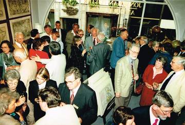
Right: A Reception in the gallery
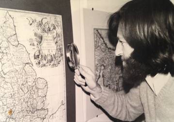
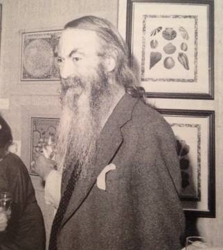
Below: Jonathan c.1978
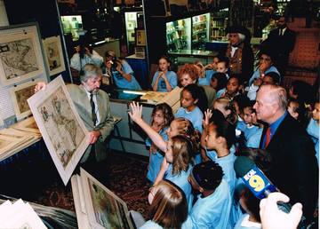
Jonathan talking to a young generation in Los Angeles, c.2000
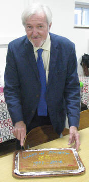
Cutting the cake to celebrate 25 years of Maps and Society (NOTE: cake is on a Mercator projection rather than a hemisphere)